The GuardianUK News & Comment• 1 min read
‘It’s not just about circling things on a map’: how our journalists use and corroborate satellite imagery
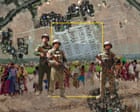
From the destruction of Gaza to climate breakdown, satellite imagery has become an indispensable reporting tool. But as a recent Guardian investigation illustrates, a lot of work goes into ensuring its veracity and keeping the focus on the people affected on the ground How to…
Read the full story at The Guardian
Havoc links to the original reporting — the full story stays with the publisher.
Was this worth reading?Sign in to vote